


Details
产品描述
IMPORTANT: BEFORE SIMDESIGNSCO
UPDATE 04/2020
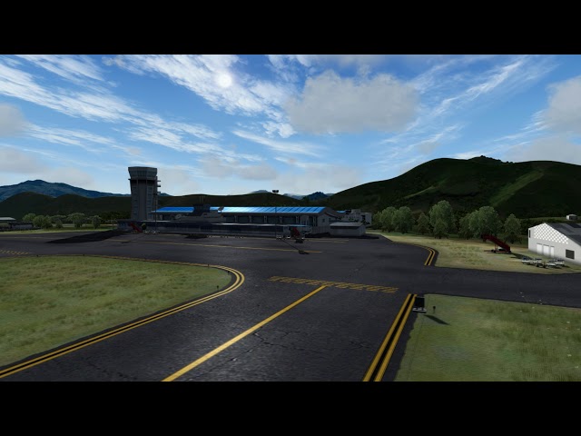
Antonio Nariño Airport (IATA: PSO, ICAO: SKPS) is located in the town of Chachagüí and serves the city of Pasto in the Nariño Department of Colombia. The airport is 35 kilometres (22 mi) north of Pasto. It handles only domestic flights in addition to military operations and private charters. A new terminal, administrative and tower control are being built, also new navigation equipment is being set up due to the increasing number of passengers and cargo flights.
The airport's runway was built on a plateau of 50 meters because of the surrounding terrain. Due to this, many pilots refer to the airport as an aircraft carrier. The runway is also relatively short for the elevation of the airport.
The position of the runway means that it is often rendered useless, since in the presence of crosswinds, it prevents aircraft making a safe takeoff and landing. Crosswinds are common during the summer, particularly during the month of August.
Features:
- Photo-realistic ground textures based on aerial images
- Real Autogen Update
- Photo-realistic textures for buildings, vehicles, etc.
- Airport Objects
- Optimized for good performance
- Compatible with Orbx, Vector, OpenLC South America, FreemeshX
- 3D grass
- GSX Ready (only P3DV4)
- New Dynamic Lights
- Windsock SODE (New)
- PBR RWY and platform texture. model update (NEW)
- New models of ALS approach lights
- Visual reference VFR aproach (Matituy and Taminango Town)
其他可选

使用需求
洛克希德马丁 Prepar3D V4.5
洛克希德马丁 Prepar3D V5
64位 Windows 7 / 8 /10
1.2 GHz 处理器
8G 内存
评价
总评论
2
平均评分


