В ПРОДАЖЕ в течение ограниченного времени!
Дней
Часы
Мин.
сек
-30%

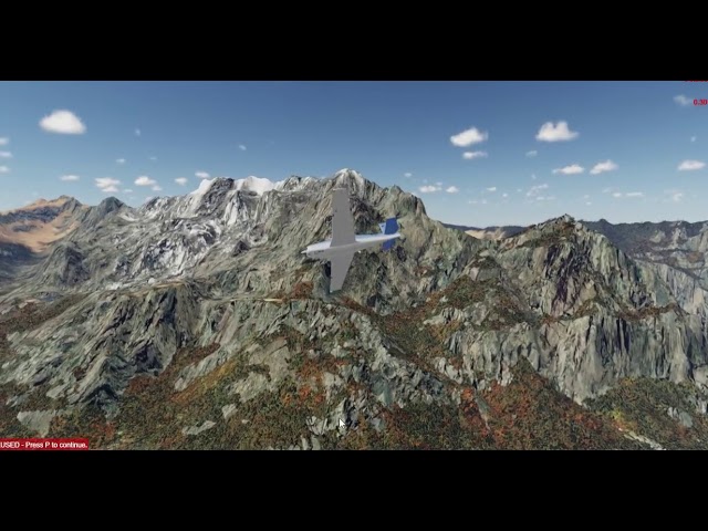
10 m terrain mesh for the whole of Austria and Switzerland built from Lidar data and compiled with 10 m resolution elevation points posts. This mesh is very light on frames rates and it does blend seamlessly with default airports avoiding any terracing around airports areas; give a new fresh look to the simulator terrain mesh; avoiding terrain distortions around airports perimeters caused by others older dated mesh.
CPU: Intel Core i5 6600K at 3.5 ghz or faster
RAM: 16 GB
VIDEO CARD: DirectX 12-capable video card - 4 GB VRAM
386 MB HD Space

COLOGNE-BONN PROFESSIONAL P3D
AEROSOFT GMBH23.49
USD 25.08
Все продажи указаны в евро. Другие валюты показаны только для справки.GBP 20.11
Все продажи указаны в евро. Другие валюты показаны только для справки.CNY 181.56
Все продажи указаны в евро. Другие валюты показаны только для справки.