




Details
AEF NaturalWonder — Mont-Blanc Massifs Vol.1
Mont-Blanc · Aiguilles Rouges · Giffre
Discover the French Alps as never before in Microsoft Flight Simulator 2020 and 2024.
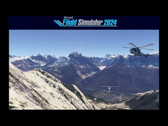
AEF NaturalWonder Mont-Blanc Massifs Vol.1 harnesses high-definition LiDAR data from the IGN (French National Geographic Institute) to deliver an absolute precision reproduction of the terrain across three of the most spectacular French Alpine massifs — Mont-Blanc, Aiguilles Rouges and Giffre.
A radical transformation of the visual experience
Thanks to our proprietary conversion tools, the finest available LiDAR data is integrated directly and efficiently into MSFS 2020 and 2024, delivering terrain accuracy 100 to 200% superior to standard data. The result is immediate and breathtaking — a visual impact from the very first flight.
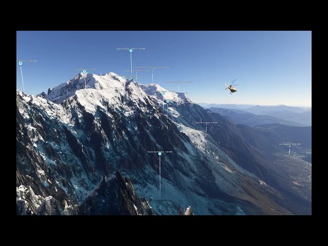
- The Aiguille du Midi, the Bossons Glacier, the Grandes Jorasses — every summit at its true elevation, in its true proportions
- The valleys of Chamonix, Samoëns and Giffre — their slopes, plateaus and ridgelines faithfully reproduced
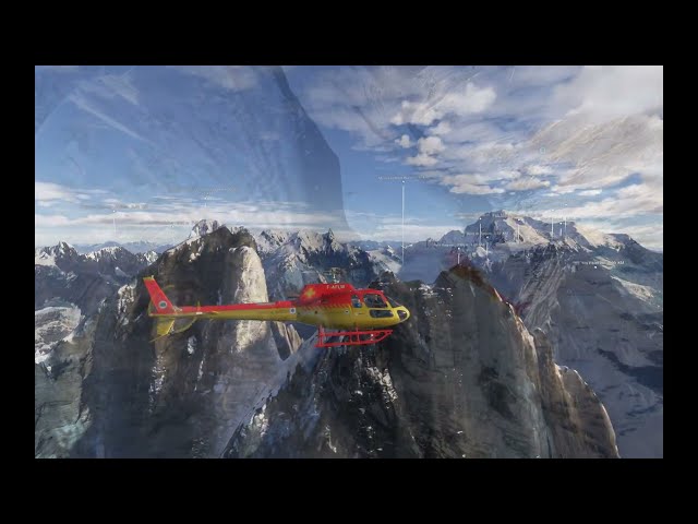
- A terrain you can feel in flight — the difference is instantly noticeable at low altitude, in helicopter, mountain flying or scenic overflights
IGN LiDAR Technology
High-definition LiDAR data from France's Institut Géographique National is the absolute reference for terrain precision. It is fully leveraged here to deliver the most authentic flying experience currently available over these massifs in MSFS.
Technology Watch & Free Updates
Accurate France maintains continuous monitoring of Microsoft Flight Simulator SDK developments. Whenever significant advances in development tools allow for improved terrain precision or rendering, this product will receive a free update for all buyers. Your investment is built to last.
Installation
The product is delivered in the proprietary encrypted .aefpkg format, exclusive to Accurate France, together with AccurateFrance_MSFS_Installer.exe — our proprietary installer that automatically detects your MSFS configuration and installs the package in just a few clicks. No third-party tools required.
AccurateFrance_MSFS_Installer.exe — a lasting tool for the entire community
Beyond our own products, our installer is fully compatible with any MSFS add-on in .zip or .rar format, whether freeware or payware, regardless of the publisher. It automatically detects your MSFS 2020 and 2024 Community folders, supports advanced configurations such as MSFS AddonsLinker, and also benefits from free updates as the simulator evolves. A unique tool, included with every Accurate France product.
Coming soon — Vol.2 : Aravis Massif · Bornes · Annecy
The same IGN LiDAR quality across the Aravis and Bornes massifs all the way to Lake Annecy — stay tuned.
Compatible MSFS 2020 and MSFS 2024
Tags
Requirements
Product Requirements :
Microsoft Flight Simulator 2020 or Microsoft Flight Simulator 2024 (Microsoft Store or Steam versions)
Minimum system requirements as recommended by Microsoft for MSFS 2020 or 2024
Windows 10 or Windows 11 (64-bit)
985 MB of available disk space for installation
AccurateFrance_MSFS_Installer.exe included in the package — no third-party tools required
Recommended Products

€ 8.99
$
USD 10.29
All sales based on Euro. Other currencies shown as reference only.£
GBP 7.71
All sales based on Euro. Other currencies shown as reference only.¥
CNY 69.79
All sales based on Euro. Other currencies shown as reference only.
€ 14.00
$
USD 16.03
All sales based on Euro. Other currencies shown as reference only.£
GBP 12.00
All sales based on Euro. Other currencies shown as reference only.¥
CNY 108.69
All sales based on Euro. Other currencies shown as reference only.
€ 15.99
$
USD 18.31
All sales based on Euro. Other currencies shown as reference only.£
GBP 13.71
All sales based on Euro. Other currencies shown as reference only.¥
CNY 124.14
All sales based on Euro. Other currencies shown as reference only.
€ 29.99
$
USD 34.33
All sales based on Euro. Other currencies shown as reference only.£
GBP 25.71
All sales based on Euro. Other currencies shown as reference only.¥
CNY 232.82
All sales based on Euro. Other currencies shown as reference only.
€ 0.00
$
USD 0.00
All sales based on Euro. Other currencies shown as reference only.£
GBP 0.00
All sales based on Euro. Other currencies shown as reference only.¥
CNY 0.00
All sales based on Euro. Other currencies shown as reference only.
€ 6.99
$
USD 8.00
All sales based on Euro. Other currencies shown as reference only.£
GBP 5.99
All sales based on Euro. Other currencies shown as reference only.¥
CNY 54.27
All sales based on Euro. Other currencies shown as reference only.
€ 10.00
$
USD 11.45
All sales based on Euro. Other currencies shown as reference only.£
GBP 8.57
All sales based on Euro. Other currencies shown as reference only.¥
CNY 77.63
All sales based on Euro. Other currencies shown as reference only.
€ 9.99
$
USD 11.44
All sales based on Euro. Other currencies shown as reference only.£
GBP 8.56
All sales based on Euro. Other currencies shown as reference only.¥
CNY 77.56
All sales based on Euro. Other currencies shown as reference only.