


Details
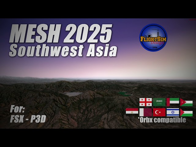
New highly detailed MESH SouthWest Asia, with a REAL resolution of 30m in High Quality, using the last data from the NASA mission SRMT.
Southwest Asia, also spelled South West Asia and South-West Asia, and also known as Southwest Asia
Detailed geographic elevation information, including countries: Turkey, Syria, Lebanon, Cyprus, Israel, Jordan, Kuwait, Iraq, Bahrain, the United Arab Emirates, Oman, Qatar, Iran, Yemen, and Saudi Arabia and more.
For FSX / P3D/ P3Dv4 / P3Dv5
Compatible with Orbx
Features:
- High Quality Coverage of South East Asia (LOD9 to LOD12)
- sophisticated new algorithm for correct views of ridges and peaks
- new algorithm for reducing irrelevant data for higher data compression and a new algorithm for finding and correcting errors
- Required 2.5GB HDD Space
Тэги
Требования
FSX / P3Dv3 /P3Dv4 / P3Dv5 / P3Dv6
Рекомендации для вас

€ 12.50
$
USD 13.99
Все продажи указаны в евро. Другие валюты показаны только для справки.£
GBP 10.53
Все продажи указаны в евро. Другие валюты показаны только для справки.¥
CNY 100.82
Все продажи указаны в евро. Другие валюты показаны только для справки.
€ 15.00
$
USD 16.79
Все продажи указаны в евро. Другие валюты показаны только для справки.£
GBP 12.64
Все продажи указаны в евро. Другие валюты показаны только для справки.¥
CNY 120.99
Все продажи указаны в евро. Другие валюты показаны только для справки.
€ 17.00
$
USD 19.03
Все продажи указаны в евро. Другие валюты показаны только для справки.£
GBP 14.33
Все продажи указаны в евро. Другие валюты показаны только для справки.¥
CNY 137.12
Все продажи указаны в евро. Другие валюты показаны только для справки.
€ 13.99
$
USD 15.66
Все продажи указаны в евро. Другие валюты показаны только для справки.£
GBP 11.79
Все продажи указаны в евро. Другие валюты показаны только для справки.¥
CNY 112.84
Все продажи указаны в евро. Другие валюты показаны только для справки.
€ 16.00
$
USD 17.91
Все продажи указаны в евро. Другие валюты показаны только для справки.£
GBP 13.48
Все продажи указаны в евро. Другие валюты показаны только для справки.¥
CNY 129.05
Все продажи указаны в евро. Другие валюты показаны только для справки.
€ 16.00
$
USD 17.91
Все продажи указаны в евро. Другие валюты показаны только для справки.£
GBP 13.48
Все продажи указаны в евро. Другие валюты показаны только для справки.¥
CNY 129.05
Все продажи указаны в евро. Другие валюты показаны только для справки.
€ 24.99
$
USD 27.97
Все продажи указаны в евро. Другие валюты показаны только для справки.£
GBP 21.06
Все продажи указаны в евро. Другие валюты показаны только для справки.¥
CNY 201.57
Все продажи указаны в евро. Другие валюты показаны только для справки.
€ 19.49
$
USD 21.82
Все продажи указаны в евро. Другие валюты показаны только для справки.£
GBP 16.42
Все продажи указаны в евро. Другие валюты показаны только для справки.¥
CNY 157.20
Все продажи указаны в евро. Другие валюты показаны только для справки.