


Details
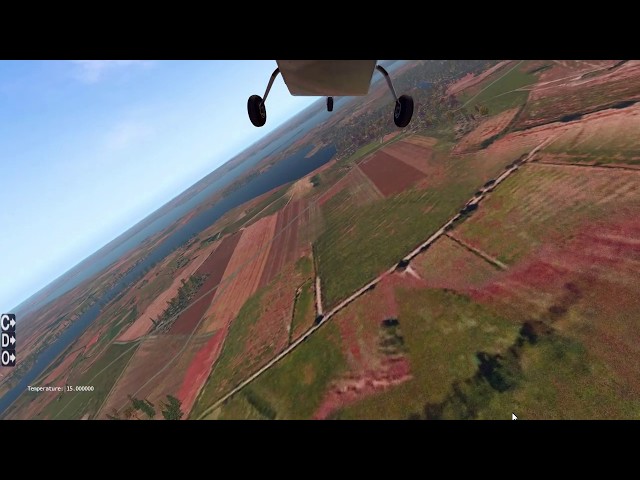
MeshXP Denmark is compiled using 10 m resolution elevation models. MeshXP function is to add elvations points to the terrain to further increase elevations precision and a better shaped terrain. Shorelines have been also upgraded to be more precise. This mesh can be used on its own or underneath photorealistic scenery. It use Xplane 11 default Vectors ie roads, landlass. Hydrology is extracted from from the latest osm data. This is an xp11 terrain mesh. Coverage: Denmark. No decrease of frame rates. All MeshXP packages are designed to fit into each over to provide continuous coverage. All MeshXP scenery work in Windows and Mac. This is a very relaxing and gentle mesh to fly; providing spectacular view of Denmark terrains.
Stichworte
Anforderungen
Requirements: CPU: Intel Core i5 6600K at 3.5 ghz or faster - RAM: 16 GB; VIDEO CARD:
DirectX 12-capable video card - 4 GB VRAM. 300 MB HD Space.
Kunden die dieses Produkt gekauft haben, haben auch diese Produkte gekauft

€ 10.99
$
USD 12.95
Alle Verkäufe in Euro. Andere Währungen werden nur als Referenz angezeigt.£
GBP 9.59
Alle Verkäufe in Euro. Andere Währungen werden nur als Referenz angezeigt.¥
CNY 90.86
Alle Verkäufe in Euro. Andere Währungen werden nur als Referenz angezeigt.
€ 11.99
$
USD 14.13
Alle Verkäufe in Euro. Andere Währungen werden nur als Referenz angezeigt.£
GBP 10.47
Alle Verkäufe in Euro. Andere Währungen werden nur als Referenz angezeigt.¥
CNY 99.13
Alle Verkäufe in Euro. Andere Währungen werden nur als Referenz angezeigt.
€ 10.99
$
USD 12.95
Alle Verkäufe in Euro. Andere Währungen werden nur als Referenz angezeigt.£
GBP 9.59
Alle Verkäufe in Euro. Andere Währungen werden nur als Referenz angezeigt.¥
CNY 90.86
Alle Verkäufe in Euro. Andere Währungen werden nur als Referenz angezeigt.
€ 20.97
$
USD 24.72
Alle Verkäufe in Euro. Andere Währungen werden nur als Referenz angezeigt.£
GBP 18.30
Alle Verkäufe in Euro. Andere Währungen werden nur als Referenz angezeigt.¥
CNY 173.38
Alle Verkäufe in Euro. Andere Währungen werden nur als Referenz angezeigt.
€ 14.99
$
USD 17.67
Alle Verkäufe in Euro. Andere Währungen werden nur als Referenz angezeigt.£
GBP 13.08
Alle Verkäufe in Euro. Andere Währungen werden nur als Referenz angezeigt.¥
CNY 123.94
Alle Verkäufe in Euro. Andere Währungen werden nur als Referenz angezeigt.
€ 24.92
$
USD 29.37
Alle Verkäufe in Euro. Andere Währungen werden nur als Referenz angezeigt.£
GBP 21.75
Alle Verkäufe in Euro. Andere Währungen werden nur als Referenz angezeigt.¥
CNY 206.04
Alle Verkäufe in Euro. Andere Währungen werden nur als Referenz angezeigt.
€ 14.99
$
USD 17.67
Alle Verkäufe in Euro. Andere Währungen werden nur als Referenz angezeigt.£
GBP 13.08
Alle Verkäufe in Euro. Andere Währungen werden nur als Referenz angezeigt.¥
CNY 123.94
Alle Verkäufe in Euro. Andere Währungen werden nur als Referenz angezeigt.
€ 23.49
$
USD 27.69
Alle Verkäufe in Euro. Andere Währungen werden nur als Referenz angezeigt.£
GBP 20.50
Alle Verkäufe in Euro. Andere Währungen werden nur als Referenz angezeigt.¥
CNY 194.21
Alle Verkäufe in Euro. Andere Währungen werden nur als Referenz angezeigt.