限时发售!
天
小时
分钟
秒
-30%
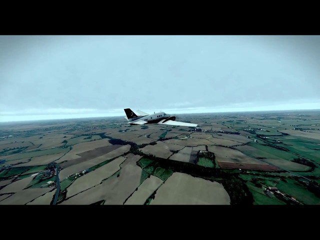
MeshXP British Isles is compiled using 30 m resolution elevation models. We used highly detailed hydrological data to rebuild completely the hydrological scenery to very high details, in short words every lake; river; pond; canal is now rendered in the scenery. This mesh also feature highly detailed Autogen buildings and vegetations; positioned as in the real world. It can be used on its own or underneath photorealistic scenery. It is fully compatible with London XP; and NightXP packages. Use Xplane 11 default Vectors ie roads,
landlass. Hydrology, buildings data are extracted from from the latest Ordnance Survey data. This is an xp11 terrain mesh. Coverage: England; Wales; Scotland. All MeshXP packages are designed to fit into each over to provide continuous coverage. All MeshXP scenery work in Windows and Mac.

USD 19.28
所有商品的售价基准为欧元,其他货币价格仅供参考!GBP 14.53
所有商品的售价基准为欧元,其他货币价格仅供参考!CNY 132.96
所有商品的售价基准为欧元,其他货币价格仅供参考!14.99
USD 17.20
所有商品的售价基准为欧元,其他货币价格仅供参考!GBP 12.97
所有商品的售价基准为欧元,其他货币价格仅供参考!CNY 118.64
所有商品的售价基准为欧元,其他货币价格仅供参考!
USD 28.60
所有商品的售价基准为欧元,其他货币价格仅供参考!GBP 21.56
所有商品的售价基准为欧元,其他货币价格仅供参考!CNY 197.23
所有商品的售价基准为欧元,其他货币价格仅供参考!
14.99
USD 17.20
所有商品的售价基准为欧元,其他货币价格仅供参考!GBP 12.97
所有商品的售价基准为欧元,其他货币价格仅供参考!CNY 118.64
所有商品的售价基准为欧元,其他货币价格仅供参考!
USD 26.96
所有商品的售价基准为欧元,其他货币价格仅供参考!GBP 20.32
所有商品的售价基准为欧元,其他货币价格仅供参考!CNY 185.91
所有商品的售价基准为欧元,其他货币价格仅供参考!16.99
USD 19.50
所有商品的售价基准为欧元,其他货币价格仅供参考!GBP 14.70
所有商品的售价基准为欧元,其他货币价格仅供参考!CNY 134.47
所有商品的售价基准为欧元,其他货币价格仅供参考!
USD 20.45
所有商品的售价基准为欧元,其他货币价格仅供参考!GBP 15.41
所有商品的售价基准为欧元,其他货币价格仅供参考!CNY 141.04
所有商品的售价基准为欧元,其他货币价格仅供参考!13.99
USD 16.05
所有商品的售价基准为欧元,其他货币价格仅供参考!GBP 12.10
所有商品的售价基准为欧元,其他货币价格仅供参考!CNY 110.72
所有商品的售价基准为欧元,其他货币价格仅供参考!