限时发售!
天
小时
分钟
秒
-30%
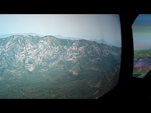
MeshXP s compiled from 10 m resolution data to make High Resolution terrain mesh for XPlane 11. MeshXP function is to add elevations points to the terrain to further increase precision; shaping valleys and mountains as real as it gets. . This mesh can
be used on its own or undeneath photorealistic scenery of any kind. It uses Xplane 11 default Vectors ie roads; streams; rivers; lakes; landclass. This is an Xp11 terrain mesh. Coverage: Hawaii - Puerto Rico -Guam. This scenery add elevation points every
10 m; No decrease of frames rates. All MeshXP terrain packages made by us are designed to provide continuous coverage fitting into each other.
16.99
USD 19.88
所有商品的售价基准为欧元,其他货币价格仅供参考!GBP 14.72
所有商品的售价基准为欧元,其他货币价格仅供参考!CNY 135.77
所有商品的售价基准为欧元,其他货币价格仅供参考!
18.49
USD 21.64
所有商品的售价基准为欧元,其他货币价格仅供参考!GBP 16.02
所有商品的售价基准为欧元,其他货币价格仅供参考!CNY 147.75
所有商品的售价基准为欧元,其他货币价格仅供参考!16.99
USD 19.88
所有商品的售价基准为欧元,其他货币价格仅供参考!GBP 14.72
所有商品的售价基准为欧元,其他货币价格仅供参考!CNY 135.77
所有商品的售价基准为欧元,其他货币价格仅供参考!
USD 31.54
所有商品的售价基准为欧元,其他货币价格仅供参考!GBP 23.35
所有商品的售价基准为欧元,其他货币价格仅供参考!CNY 215.36
所有商品的售价基准为欧元,其他货币价格仅供参考!13.99
USD 16.37
所有商品的售价基准为欧元,其他货币价格仅供参考!GBP 12.12
所有商品的售价基准为欧元,其他货币价格仅供参考!CNY 111.79
所有商品的售价基准为欧元,其他货币价格仅供参考!
USD 16.38
所有商品的售价基准为欧元,其他货币价格仅供参考!GBP 12.13
所有商品的售价基准为欧元,其他货币价格仅供参考!CNY 111.87
所有商品的售价基准为欧元,其他货币价格仅供参考!
USD 11.69
所有商品的售价基准为欧元,其他货币价格仅供参考!GBP 8.65
所有商品的售价基准为欧元,其他货币价格仅供参考!CNY 79.83
所有商品的售价基准为欧元,其他货币价格仅供参考!13.99
USD 16.37
所有商品的售价基准为欧元,其他货币价格仅供参考!GBP 12.12
所有商品的售价基准为欧元,其他货币价格仅供参考!CNY 111.79
所有商品的售价基准为欧元,其他货币价格仅供参考!